
The Chronicle
![]()
Nqobile Tshili, Chronicle Reporter
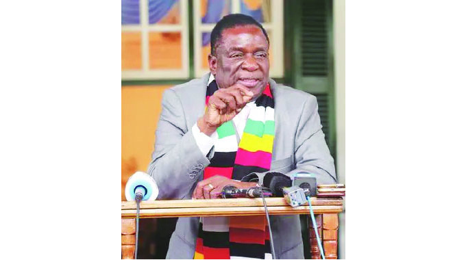
ZIMBABWEANS have always looked up into the night sky, but they never dreamed that one day the country would occupy space and “dance with aliens”. But in a few hours, the fantasy the nation had never conjured up — that is until President Mnangagwa came into power — will become reality.
On October 4, 1957, Russia became the first country to launch the first artificial satellite, Sputnik 1, into space. That “colonisation” of space fuelled a technological sprint that saw the United States and other countries follow suit in exploring space.
At 11am tomorrow Zimbabwe will join the league of nations that have launched satellites into space when it sends its first satellite, ZimSat-1, into orbit after developing it through the BIRDS project.
The Live coverage and countdown commentary will begin at (11:30am Zimbabwe Time) 5:30 a.m. EST on Sunday, November 6, and air on NASA Television and the agency’s website, as well as YouTube, Twitter, and NASA’s App.
The launch of ZimSat-1 is a culmination of a process that commenced in 2018 when President Mnangagwa launched the Zimbabwe National Geospatial and Space Agency (ZINGSA). The development is part of the country’s plan to meet other nations and become an upper-middle-income economy by 2030. President Mnangagwa pledged more support to ZINGSA to see the growth of a technology innovation environment that supports the development and use of new technologies.
It is also a milestone that will enhance mineral exploration and monitoring of environmental hazards and droughts. Additionally, it will aid in mapping human settlements and disease outbreaks, among other capabilities.
 President Mnangagwa
ZimSat-1, a nanosatellite, will deploy from the Japanese KIBO Module after a long delay caused by Covid-19. The satellite is a 1U educational and amateur radio mission CubeSat manufactured under the Kyushu Institute of Technology in Japan. Many experts consider the programme the first baby steps of the country’s fledgling space programme.
ZINGSA co-ordinator Painos Gweme said the launch will kick-start the transformation of Zimbabwe.
“The first one is the rocket leaving earth to the international space station where it is going to dock and take out the cargo into the international space station. And this one is going to start on 6 November. The actual deployment of ZimSat-1 into space will be through the Japanese module.
“Remember we are doing this satellite development together with the Japanese. It is going to be deployed in the KIBO module, it happens after two-three weeks after this November 6 and we have scheduled for November 21. There can be some changes, it is not definite and guaranteed that on November 26 it is going to get into deployment. It will depend on the weather and other issues.”
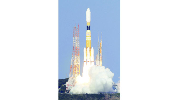 The launch of a Japanese space ship
Gweme said the country will use the satellite to access real time information that can aid development.
“This has a multi-sectoral camera which has a remote standing camera which we are going to use primarily for agricultural application, crop yield estimation, land cover and land use. We can see our forestry and the change over time because it has what we call a store and forward mission as part of the pilot which we are going to use together with the ground centre terminal,” said Gweme.
The satellite has sensors which can be used to sense humidity and this information can be downloaded at the ground station in Mazowe, Mashonaland Central. It can also be used for urban and rural planning.
The work towards occupying space has seen three Zimbabwean scientists being trained. They will be in charge of the satellite launch programme.
 covid-19
“Through this satellite, we managed to develop human capital. For the past two years, our teams have been training in Japan on how to assemble, design and test and launch satellites. So, they are coming to launch, so we now have skills back home.
“So we are going to do everything, development, management and assembling. The launch pad is a bigger project and we don’t have it right now but sooner we will have to work them over here. But other things we are now capable of doing ourselves. We sent three guys who are coming back with masters and another with a doctorate in aerospace engineering.
Since its launch, ZINGSA has developed a National Wetlands Masterplan through its Geospatial Science and Earth Observation department. The department also developed a Revised Agro-Ecological Map for Zimbabwe.
“We have done the wetland masterplan for the country for the Environmental Management Authority.
We have revived the agro-ecological map which was last done in 1964 and we have redone it to conform to what is obtaining now.
“We have done aerial mapping to identify dysfunctional areas in all cities through the use of drones. We now give local authorities information on those who are occupying land illegally,” he said.
@nqotshili
Article Source: The Chronicle